Perpendicular


When confronting an obstacle, there’s no reason to run. Start with a better world at the center, overcome the inevitable barriers, then expand to encompass more territory.
Impediments need not hinder growth.
When confronting an obstacle, there’s no reason to run. Start with a better world at the center, overcome the inevitable barriers, then expand to encompass more territory.
Impediments need not hinder growth.

The sky had changed from clear, sunny cold, to driving sleet and mist.
Wrapping myself in my shaggy jacket of the cloth called bearskin, I fought my way against the stubborn storm.
Entering, I found a small scattered congregation of sailors, and sailors’ wives and widows.
A muffled silence reigned, only broken at times by the shrieks of the storm.
Each silent worshipper seemed purposely sitting apart from the other, as if each silent grief were insular and incommunicable.
The chaplain had not yet arrived; and there these silent islands of men and women sat steadfastly eyeing several marble tablets, with black borders, masoned into the wall on either side the pulpit.
Moby Dick, Chapter 3 – The Chapel, by Herman Melville

Forward – If, in this annual, the staff of ’36 can help to cast a backward glance over many pleasant, carefree hours spent in M.H.S. and cause us to live again those happy days of youth, we have reached our goal.
Fort Myers High School
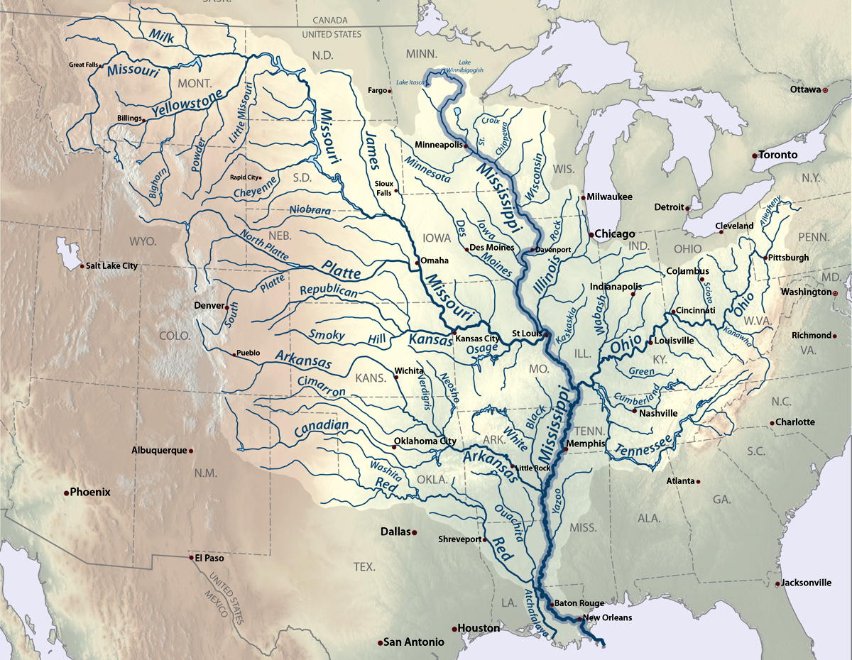
Perception of time will eventually condense into an infinite now. Until then, observe the rush of random thoughts as they travel downstream.


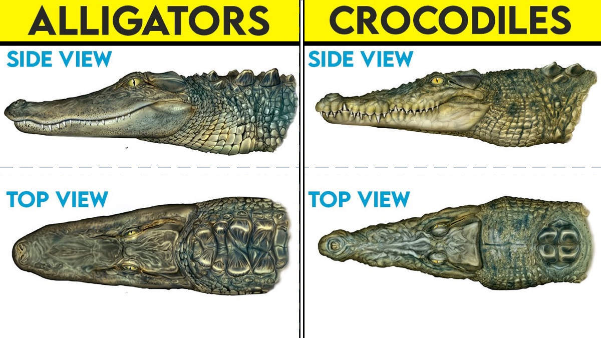
Florida Everglades is the only place on earth in which both alligators & crocodiles coexist.
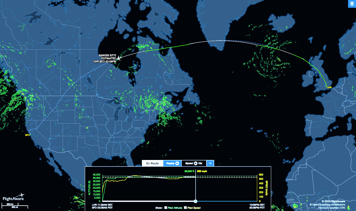
Non-stop flight from London to San Francisco shows up as a curve on a Mercator Projection map of the Northern Hemisphere. The trip takes 11 hours at 36,000 feet altitude in the cramped fuselage of the Boing 777 jet airliner traveling up to 590 mph.
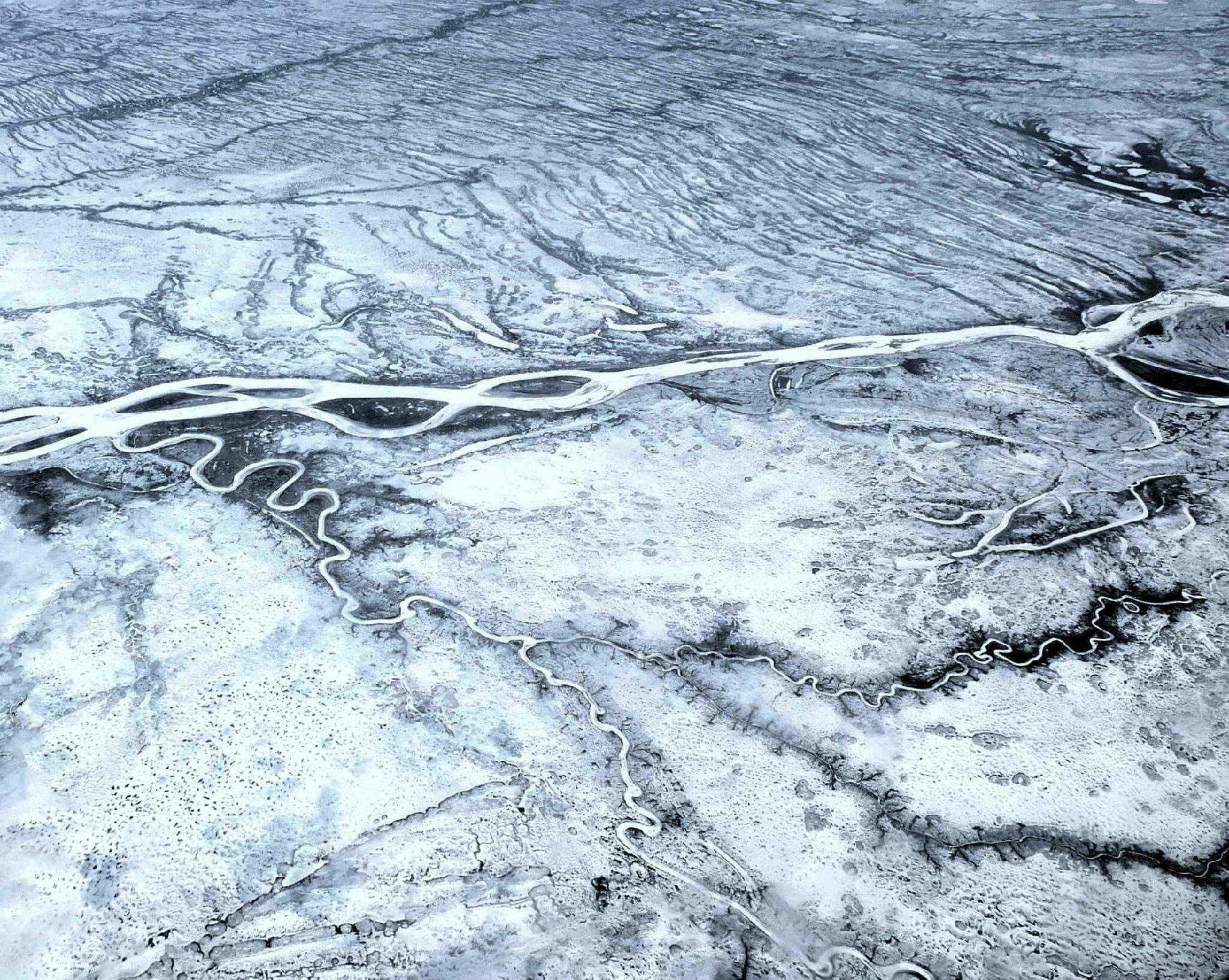
Return flight over Greenland across Hudson Bay into Manitoba, exposed scenes of boundless, deathly, frozen landscape.

Tells a lot about wind direction.
per·am·bu·late (verb)

Flag Hill at Sunol Wilderness is a slab of ancient sea floor which, in response to pressure from below, was tilted up more on one side than the other, revealing a cross-section of its sedimentary layers.

The hill shows a vegetation pattern typical of the inner coast ranges. During summer, the hot sun dries the south-facing slope. Only grassland and soft chaparral can survive under these conditions. On the north-facing slope where moisture lasts longer, trees thrive.

Sunol is one of the most beautiful parks in the Bay Area.